
*** WARNING – TYRANNY OF DRAGONS SPOILERS AHEAD ***
As soon as you have an encounter taking place with flying creatures (including PCs) or terrain that isn’t a flat plain, you get that tension between how simple or abstract you want to get for ease of play pulling against how crunchy and precise you want for the tactical element. For some games, Theater of the Mind works better than others for just abstracting things as “Yup, you’re in range” and “Not in range, but do a full move this turn and you can be there to attack next turn”. Despite me usually being someone with a decent grasp of spatial relations, I’ve often struggled with keeping track of multiple PCs and their opponents and with describing it to others so I usually fall back on some form of visual tracking. My D&D play has usually been very tactical so I thrive on using a map in some way.
Typically, I use some form of dice and a colorful clothespin on a mini to track it’s height and use a Pythagorean shortcut. My preferred die is either a d12 (to mark how many units up – chosen as it’s rarely used in most games and is often large enough to act as a platform for a minifig) or a d100 (to track 05, 10, 15, etc.). It clutters up the map some and doesn’t really work for when one creature or element is above or below another one. The math shortcut I use is to measure the horizontal and vertical distances, add half the shorter distance to the longer distance. It’s not perfect, but it’s close enough for gaming.
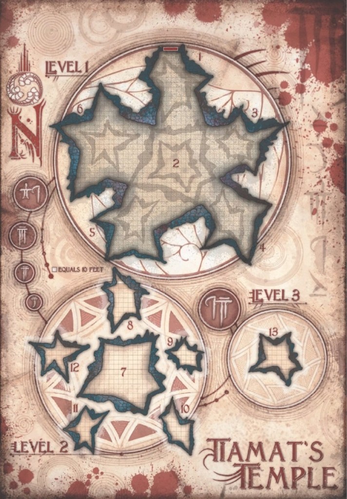
For Roll20, I do have little token markers to indicate flight height but honestly they are really small and a bit of a pain to adjust and even more to read on a large map. Flight was going to be a significant tactical matter for this final battle inside the caldera of an extinct volcano. The best description was one giant upside down ice cream cone surrounded by five slightly smaller ice cream cones with the small cones overlapping the large cone on five sides. The map provided in the module breaks it down into three maps at ground level, 50 feet up, and 100 feet up.
It’s a huge map and I was already experiencing major lag and other tech problems with Roll20 for large maps. My choice was to condense it all to one map and use a mini vertical map to indicate the altitude of each character. What’s the points to having up to 150 feet of play space if it isn’t going to get used? To that end, I set up chanting cultists at the peaks of each of the ‘cones’. There were a few other complications of extra creatures added in for various reasons (including dragons from a previous encounter that had been driven away that wound up in this encounter). The Roll20 result was this –
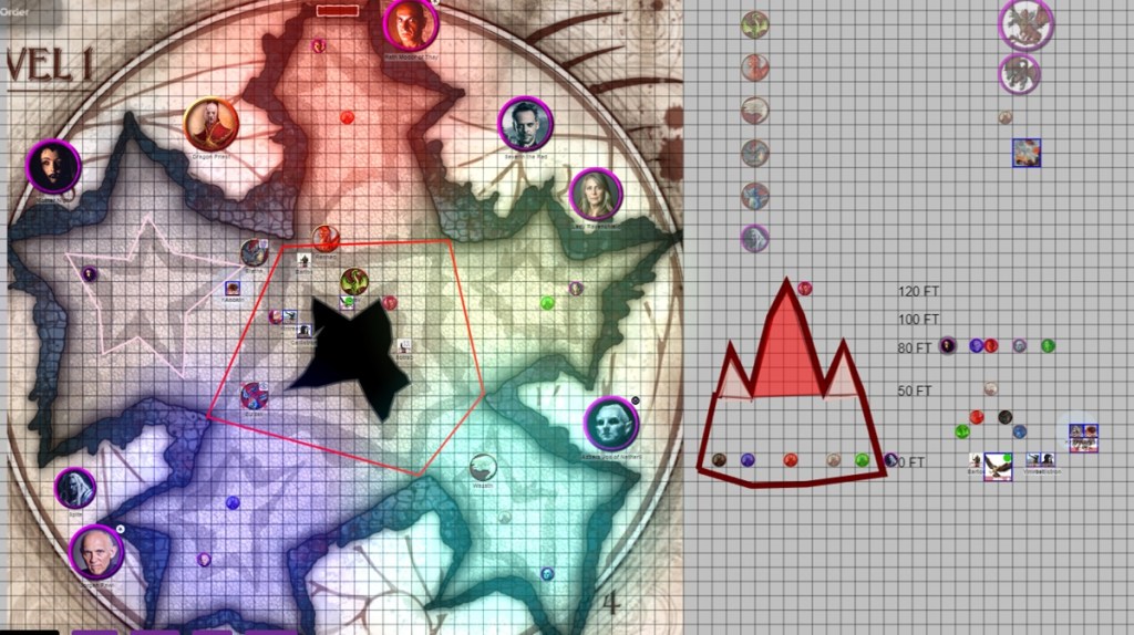
I designated certain heights as containing a narrow 10 foot ledge around the inside of the cone so that melee engagement was a possibility and creatures could snipe without having to concentrate on flight at the same time. That might have been an error, but I’ll see as the encounter progresses. Instead of working out the strict line of sights, I set it up as zones. Below 50 feet everything could see everything unless there was a wall in the way. Above fifty feet, one had to be in the zone of the cone (as marked by the red line to further simplify at what point one crossed the jagged grey boundary) to have line of sight above fifty feet. The pink was to draw attention to the inner ‘stars’, that the higher peaks were narrower and limited in space. Then to the right, a token for each character was set up according to what altitude they were at on the map (still one square = 10 feet, so not the most majestic peaks with such a broad base compared to the heights). Tokens for large creatures acting as mounts were placed only on the altitude tracker unless they were separated from their riders.
Due to the immense size of the map (about 450 feet across according to the scale!), I set up large identifying tokens for the named villains as I felt it important to have emotional hooks (one caster had a vendetta against a PC, another caster was responsible for the death of a PC parent, and one caster had escaped the PCs after a very humiliating period of captivity, etc.). The zones were color coded to give each one a little more distinction and an indication of what sort of elemental damage might be encountered. I wanted each cone / zone to have a specific theme to it and that a prepared adventurer would fare better when stepping into a particular element.
That’s a lot of moving parts to an encounter. The bright side, Roll20 has features that allow for measuring distance across a plane and a quick and dirty Pythagorean short cut could reckon what the rough diagonal was. The downside, I don’t think I explained the layout well enough to the players and there was a significant amount of reiterating those details. I attempted to use more than one way to explain it as the first way didn’t connect but that might have muddied some waters further. Currently, it seems to be working but I’m taking notes for future attempts to map 3D movement over a 2D map.
Overall, I still like how I laid it out, but going to continue to look for other alternatives to plunder and adopt to improve upon this. I’ve used a couple of other means to create engaging terrain, though usually in person on a standard playing map.
Discover more from A Geek for All Seasons
Subscribe to get the latest posts sent to your email.
